Practice reading ocean floor maps and explaining how trenches and ridges form at plate boundaries.
Read each problem carefully. Use evidence from maps, profiles, and data when needed. Show your work in the space provided.
Interpreting seafloor maps, mid-ocean ridges, and deep-ocean trenches
Earth Science - Grade 6-8
- 1
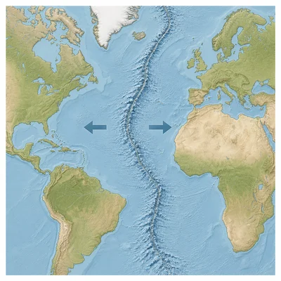
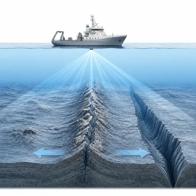
A map of the Atlantic Ocean shows a long underwater mountain chain running roughly north to south near the center of the ocean basin. Identify this feature and explain what type of plate boundary is found there.
- 2
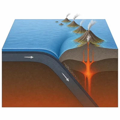
A deep, narrow valley on the ocean floor is found next to a chain of volcanic islands. What ocean floor feature is most likely present, and what process forms it?
- 3
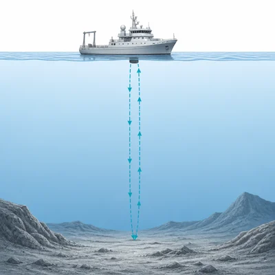
A sonar ship sends a sound pulse to the seafloor. The pulse returns after 8 seconds. If sound travels through seawater at about 1,500 meters per second, what is the ocean depth at that location?
- 4
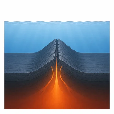
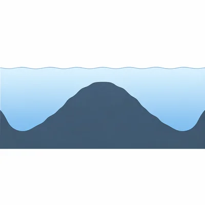
An ocean floor profile shows a seafloor depth of 3,000 meters, then a raised ridge at 1,500 meters deep, then a return to 3,000 meters deep. Explain why the ridge appears shallower than the surrounding seafloor.
- 5
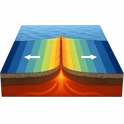
Scientists find that rocks close to a mid-ocean ridge are younger than rocks farther away from the ridge. What does this pattern show about the ocean floor?
- 6
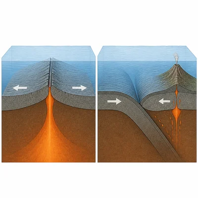
Compare a mid-ocean ridge and a deep-ocean trench. Describe one way they are similar and one way they are different.
- 7
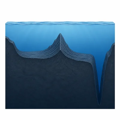
A student labels the deepest part of an ocean floor map as a mid-ocean ridge. Explain why this label is probably incorrect.
- 8
Use the following seafloor data from a ship traveling across an ocean basin: Point A is 4,000 meters deep, Point B is 2,200 meters deep, Point C is 1,600 meters deep, Point D is 2,300 meters deep, and Point E is 4,100 meters deep. Which point is most likely on a ridge, and how do you know?
- 9
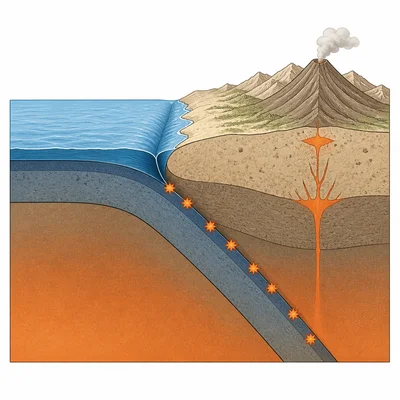
On a map, a deep trench is located along the edge of the Pacific Ocean near a continent. Earthquakes are common in this area. Explain how the trench and earthquakes are related.
- 10
Why is mapping the ocean floor important for understanding plate tectonics?