Why GPS Knows Where You Are
Tiny time differences become a map position
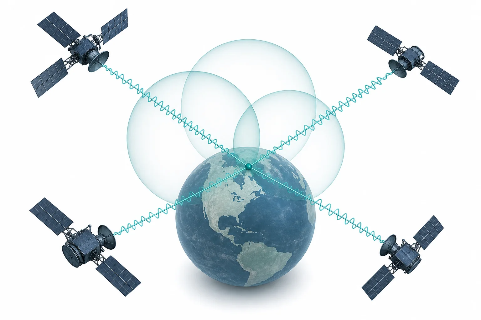
GPS works by timing radio signals from satellites. Each time measurement tells your receiver how far it is from one satellite. With signals from several satellites, the receiver finds the one place where all those distances fit.
A phone does not know where it is by looking at a map first. It starts with timing. GPS satellites carry very accurate clocks and send radio signals that include the time the signal left the satellite. Your receiver compares that time with the time the signal arrives. Since radio waves travel at the speed of light, the time gap can be turned into a distance using $d = c\Delta t$. One signal gives a huge sphere of possible places. Two signals narrow the options. Three and four signals pin the answer down and correct the receiver clock. This is why GPS is really a physics system, not just a map app. It depends on wave speed, measurement uncertainty, and geometry. If you want to connect this idea to graphs and motion, try a related graphing calculator or a LivePhysics lab after the lesson.
Satellites send time
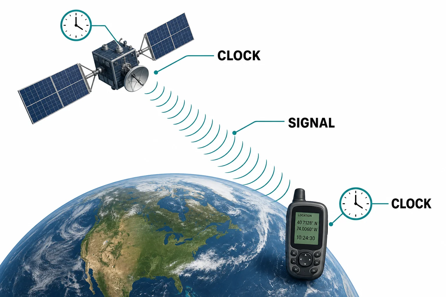
GPS distance starts as a time measurement.
Time becomes distance
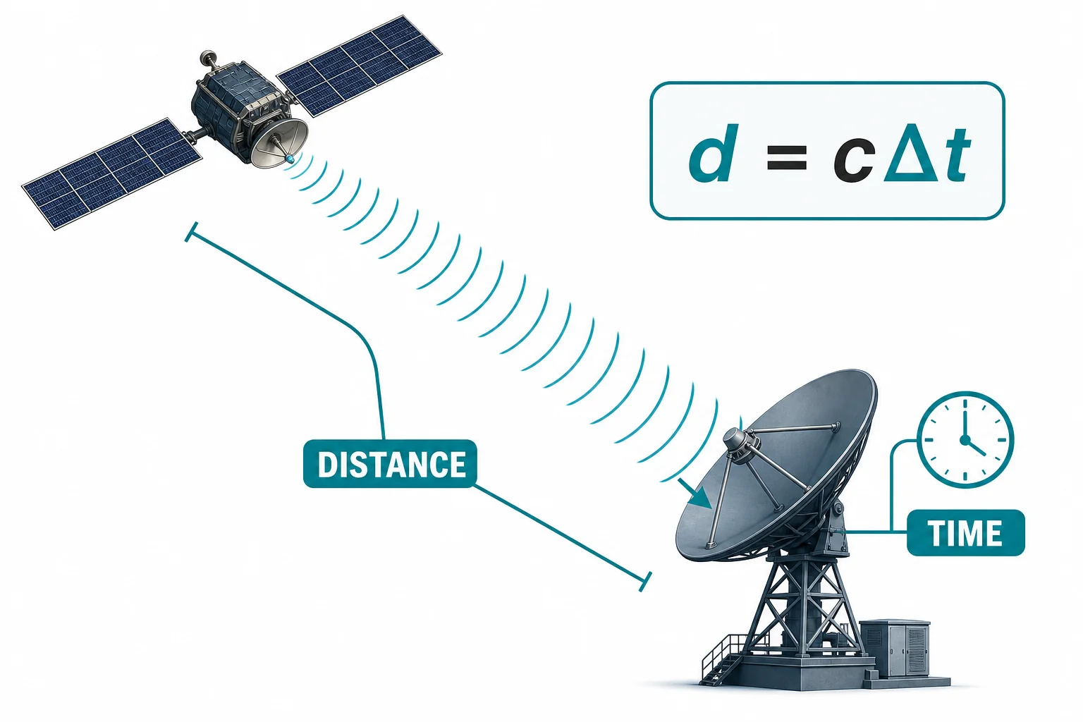
A few nanoseconds matter when signals move at light speed.
One distance is not enough
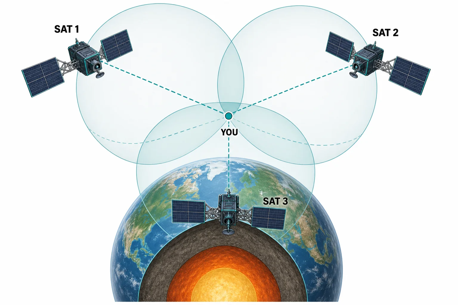
GPS finds the overlap of several distance clues.
Four signals fix the clock
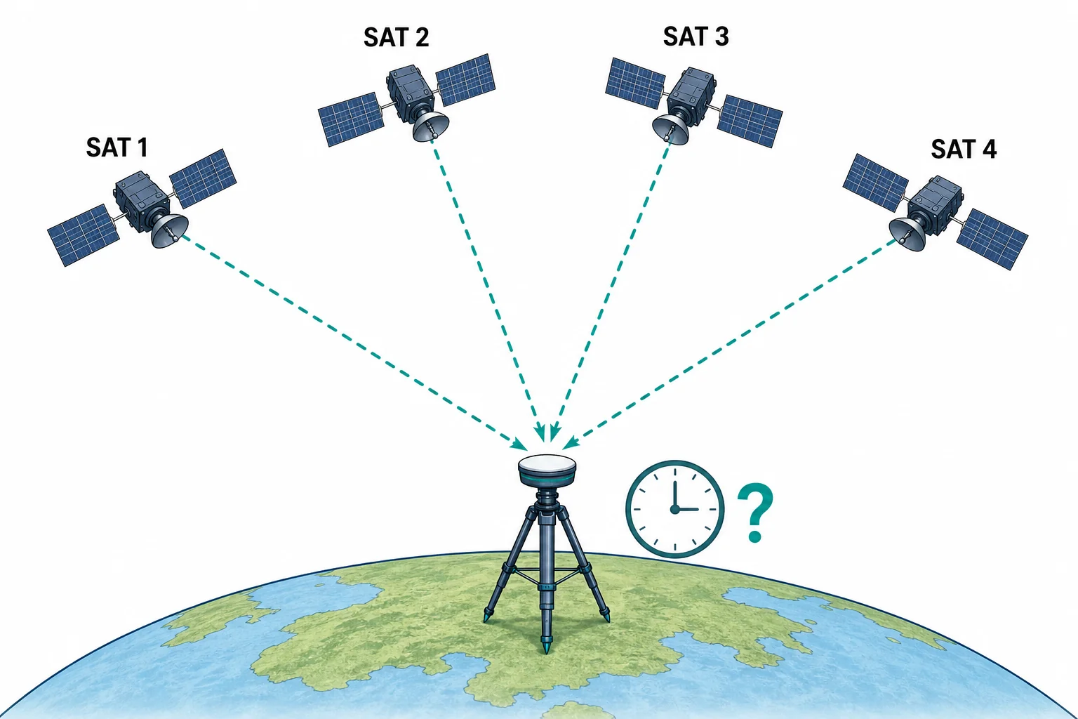
Position and clock error are solved together.
Errors shape the blue dot
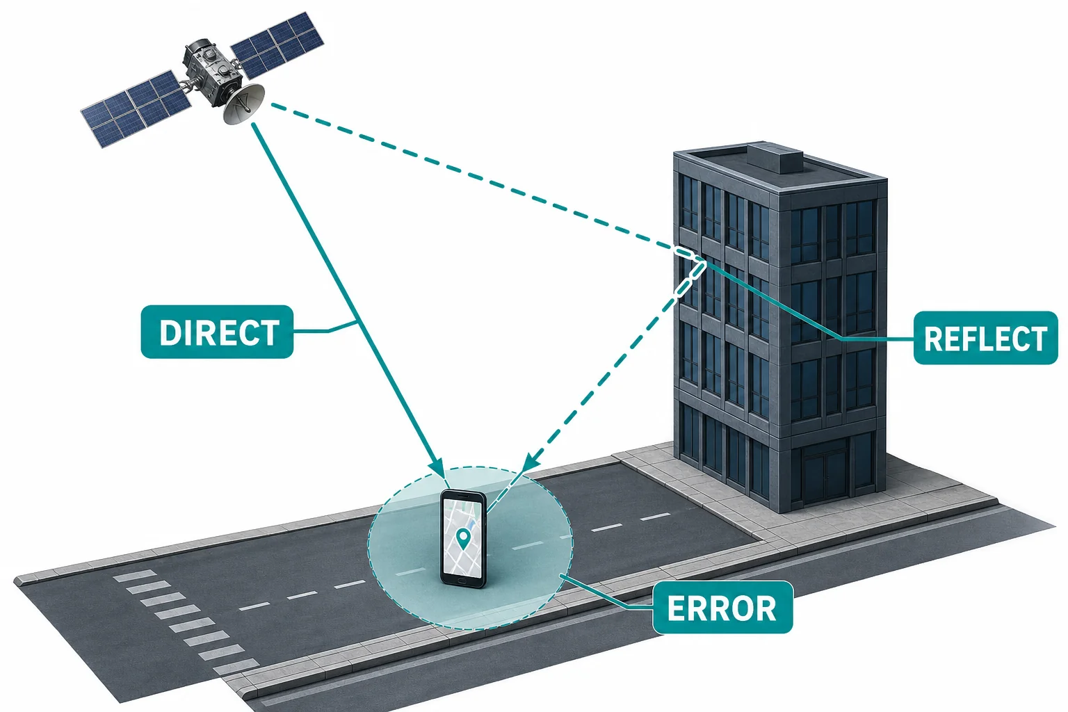
GPS accuracy depends on both physics and signal conditions.
Vocabulary
- GPS
- A satellite navigation system that lets receivers estimate position from timed radio signals.
- Trilateration
- A method for finding a location by using distances from known points.
- Radio wave
- An electromagnetic wave used to carry information through space and the atmosphere.
- Atomic clock
- A clock that keeps very accurate time by using regular changes in atoms.
- Signal delay
- The time between when a signal is sent and when it is received.
- Uncertainty
- The range of possible error in a measurement or calculation.
In the Classroom
String trilateration map
25 minutes | Grades 9-12
Place three fixed points on a paper map and give students three distances to an unknown point. Students use string or compasses to draw circles and find the overlap. Connect the model to GPS by discussing why real receivers use spheres instead of flat circles.
Timing error calculation
20 minutes | Grades 9-12
Students calculate how far light travels in 1 microsecond, 100 nanoseconds, and 10 nanoseconds. They compare those distances with the size of a classroom, a city block, and a football field. This shows why GPS clocks must be extremely accurate.
Multipath signal model
30 minutes | Grades 9-12
Use a flashlight, a mirror, and a target to model direct and reflected paths. Students compare the lengths of the two paths and explain why a reflected signal can make a receiver overestimate distance. The activity links ray diagrams to real GPS errors.
Key Takeaways
- • GPS satellites send timed radio signals to receivers on Earth.
- • A receiver turns signal travel time into distance using the speed of light.
- • One satellite gives many possible locations, while several satellites narrow the answer.
- • A fourth satellite helps correct the receiver clock error.
- • Atmosphere, reflections, satellite motion, and relativity all affect GPS accuracy.