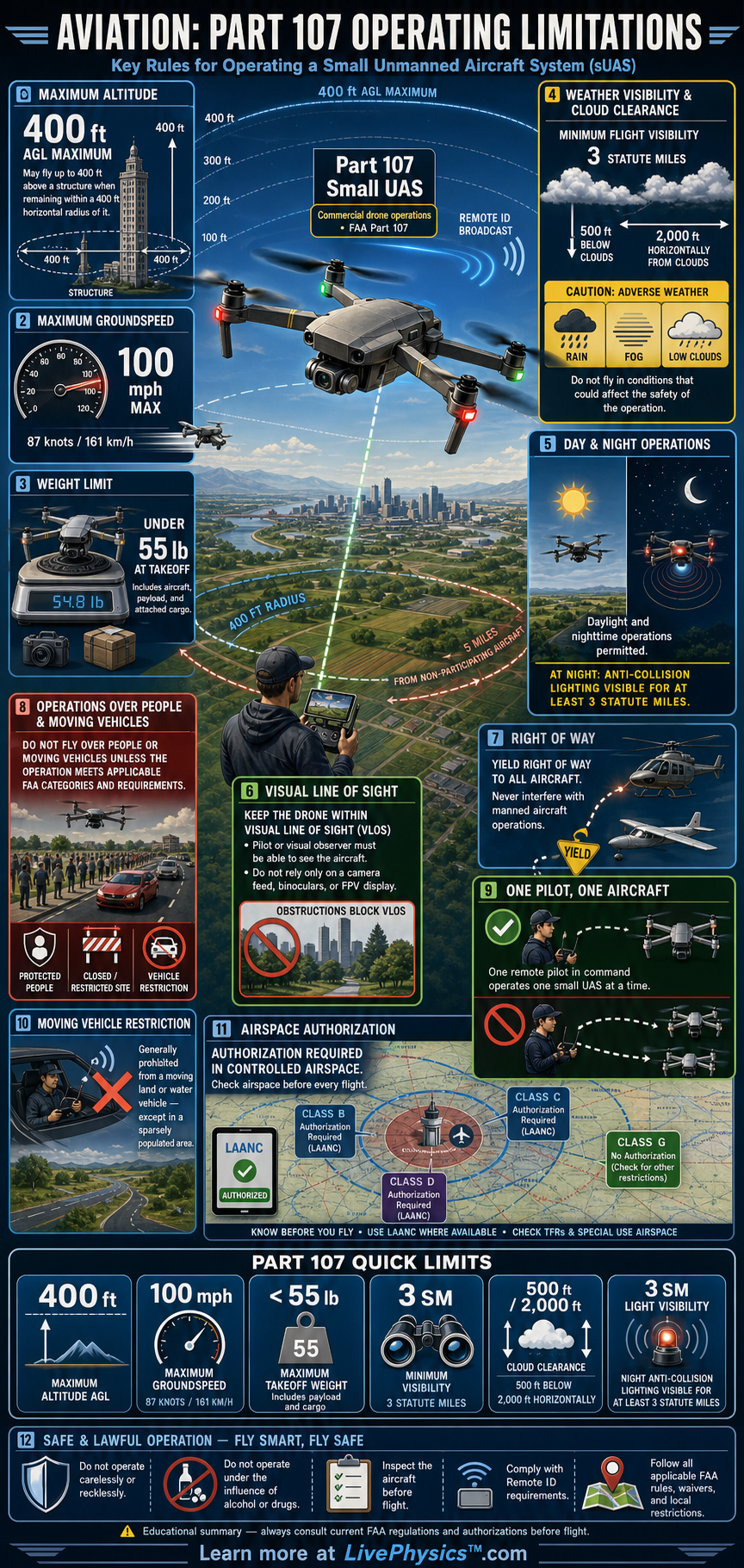
Part 107 sets the operating limits for most commercial small unmanned aircraft flights in the United States. These limits protect people on the ground, other aircraft, and the pilot's aircraft. A remote pilot must know the limits before each flight because conditions can change from one location to another.
Safe flight begins with planning, not with takeoff.
The basic operating envelope includes altitude, speed, visibility, cloud clearance, visual observation, and airspace rules. Most flights must stay at or below 400 feet above ground level and no faster than 100 miles per hour. The remote pilot or a visual observer must keep the drone within visual line of sight.
Some operations need FAA authorization, waivers, or compliance with special rules before they can occur legally.
Understanding Aviation, Part 107 Operating Limitations
Part 107 applies to civil small unmanned aircraft that weigh less than 55 pounds at takeoff. The remote pilot in command has final responsibility for every flight. That person must inspect the aircraft, assess the site, and decide whether conditions are safe.
A flight can be legal on one day yet unsafe on another because weather, nearby activity, or airspace restrictions have changed. Preflight planning is therefore a required safety habit, not just paperwork.
Altitude is one of the most important limits. The normal ceiling is 400 feet above ground level. A drone may fly higher when it remains within 400 feet of a structure, measured horizontally, and stays no more than 400 feet above that structure's immediate uppermost limit.
This rule can support inspection work on tall towers or buildings. It does not create permission to travel at high altitude away from the structure. Pilots need to understand the terrain below the drone because ground level can rise or fall across a flight area.
Weather limits help keep the drone visible and separated from manned aircraft. Flight visibility from the control station must be at least three statute miles. The drone must stay at least 500 feet below clouds and 2,000 feet horizontally from clouds.
Clouds can hide helicopters, airplanes, and the drone itself. Wind deserves close attention too, even though Part 107 does not set one universal wind-speed limit. A pilot must compare wind conditions with the aircraft's capability, battery reserve, and planned route.
Visual line of sight means the remote pilot or visual observer can see the unmanned aircraft throughout the flight without binoculars or a camera view. A first-person video screen can provide useful information, yet it does not replace direct visual observation. The observer must be able to judge the aircraft's location, direction, attitude, and nearby hazards.
This requirement limits how far a drone can travel, even when its radio link reaches much farther. Buildings, trees, hills, haze, and glare can quickly make visual observation unreliable.
Other limitations depend on the operation and location. Flights in controlled airspace generally require FAA authorization, often obtained through an approved system. Operations over people or moving vehicles must meet specific Part 107 categories and aircraft requirements.
Night operations require proper anti-collision lighting visible for at least three statute miles. Remote ID rules require most drones to broadcast identification and location information during flight. Students should focus on connecting each limit to its purpose, which is maintaining separation, visibility, control, and accountability.
Key Facts
- Maximum takeoff weight < 55 lb
- Maximum groundspeed = 100 mph = 87 knots
- Normal maximum altitude = 400 ft AGL
- Structure altitude limit = 400 ft above the structure within a 400 ft horizontal radius
- Minimum flight visibility = 3 statute miles
- Cloud clearance = 500 ft below clouds and 2,000 ft horizontal from clouds
Vocabulary
- Above Ground Level
- Above Ground Level, or AGL, measures altitude from the surface directly below the aircraft.
- Visual Line of Sight
- Visual line of sight means the remote pilot or visual observer can directly see the drone well enough to control it safely.
- Controlled Airspace
- Controlled airspace is airspace where air traffic control manages aircraft operations and drone flights often need FAA authorization.
- Remote ID
- Remote ID is a system that broadcasts identification and location information from a drone during flight.
- Remote Pilot in Command
- The remote pilot in command is the certificated person responsible for the safety and legal compliance of a drone operation.
Common Mistakes to Avoid
- Using 400 feet as a height above the launch point is wrong because the normal limit is measured above the ground directly below the drone. Changing terrain can make the drone exceed its legal altitude.
- Assuming a camera feed counts as visual line of sight is wrong because the pilot or observer must directly see the aircraft. Video cannot reliably show every nearby aircraft or obstacle.
- Flying close to clouds is wrong because Part 107 requires at least 500 feet below clouds and 2,000 feet horizontally from them. Clouds reduce visibility and can conceal manned aircraft.
- Treating controlled airspace as automatically available is wrong because many controlled locations require FAA authorization before flight. A low planned altitude does not remove that requirement.
Practice Questions
- 1 A drone is flying over flat ground at 385 feet AGL. It climbs 30 feet. Is its new altitude within the normal Part 107 altitude limit, and by how many feet?
- 2 A cloud base is 1,200 feet AGL. What is the highest altitude a drone may fly while meeting the required vertical cloud clearance, assuming the normal 400 foot AGL limit still applies?
- 3 A pilot can see the drone on a video screen beyond a row of trees, but neither the pilot nor a visual observer can directly see it. Explain why continuing the flight does not meet the visual line of sight requirement.