Sign in to save

Bookmark this page so you can find it later.

Sign in to save

Bookmark this page so you can find it later.

Earth Science middle-school May 20, 2026

Why Mountains Have Snow on Top in Summer

High peaks stay cold above warm valleys

A summer mountain landscape showing a warm green valley below and snow remaining on the colder summit above.

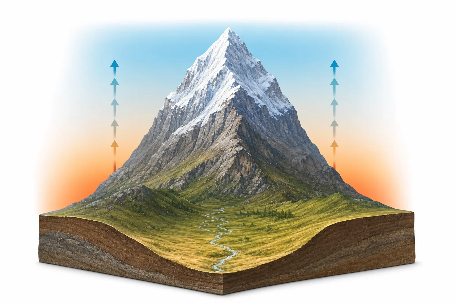
Mountaintops stay snowy in summer because air is colder high above sea level. Snow can fall there even when valleys are warm, and old snow melts slowly. If more snow piles up than melts, a white cap remains.

Big Idea. NGSS MS-ESS2-5 connects mountain snow to how energy and matter move through Earth systems.

A mountain can look like it is in two seasons at once. The lower slopes may have flowers, streams, and warm air. The top may still hold snow in July. This happens because temperature changes with height. As air rises up a mountain, it spreads out in lower air pressure. Spreading air cools. In many parts of the lower atmosphere, the temperature drops about $6.5\,^{\circ}\mathrm{C}$ for every $1\,\mathrm{km}$ of height. That pattern is called the atmospheric lapse rate. It is not the same every day, but it is a useful guide. A peak that is several kilometers high can be cold enough for snow while the valley below feels like summer. Snow also reflects sunlight and can stay frozen longer in shaded bowls, north-facing slopes, and places where storms add more snow than summer can melt.

Air gets colder with height

A side view of a mountain with warm air near the valley and colder air near the summit, shown with a simple vertical temperature scale.
Temperature often drops with altitude
The main reason high mountains keep snow is simple. Higher places are colder. Air near sea level is squeezed by the weight of the air above it. Higher up, there is less air pressing down. Rising air expands into that lower pressure, and expansion cools the air. On average, the lower atmosphere cools by about $6.5\,^{\circ}\mathrm{C}$ for each kilometer of height. This average is called the environmental lapse rate. Real weather changes it from day to day. A valley at $25\,^{\circ}\mathrm{C}$ can sit below a summit near freezing if the mountain rises several kilometers. That is why hikers can start in short sleeves and reach snow higher on the trail. The mountain is not making cold. It is reaching into a colder part of the atmosphere.

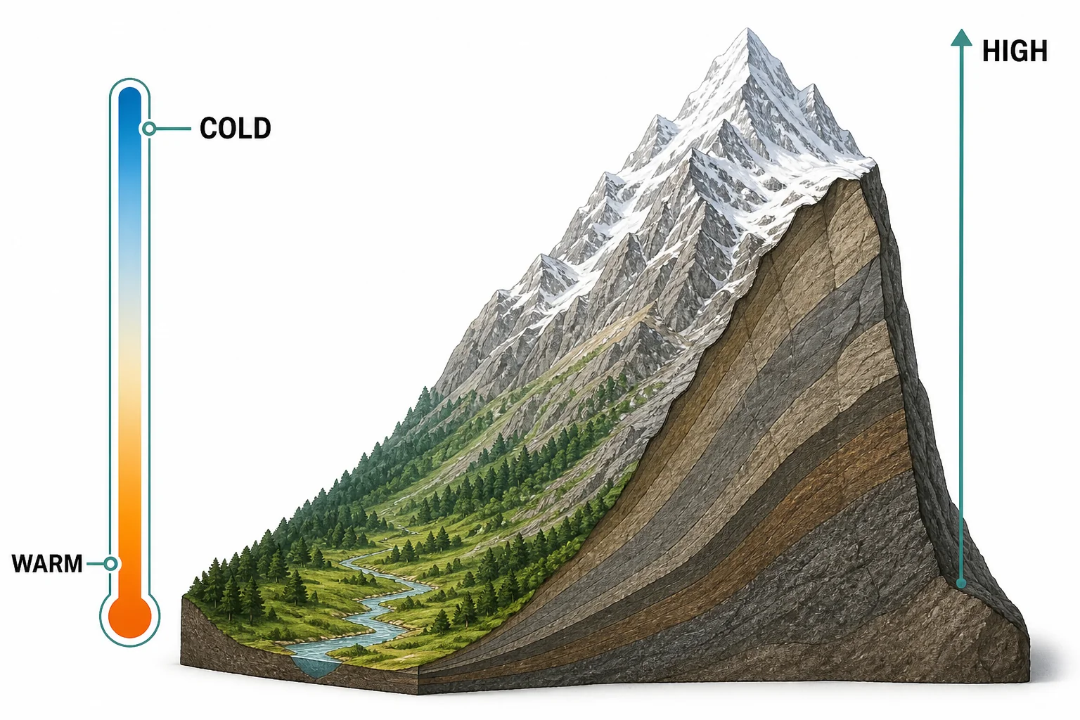
Higher altitude usually means lower temperature.

Pressure helps explain cooling

Air moving up a mountain expands in lower pressure, cools, and forms a small cloud near the upper slope.
Rising air expands and cools
Air pressure drops as altitude increases. That matters because air changes temperature when it expands or is compressed. When a pocket of air moves uphill, it enters lower pressure. The pocket spreads out. Its molecules do work as they push outward, so the air pocket loses energy and cools. This is why clouds often form around mountain slopes. Cooling air can reach the temperature where water vapor begins to condense. If the air is cold enough, the water can freeze into snow crystals. A warm valley can sit under the same sky as a snowy ridge because the ridge is surrounded by lower-pressure, colder air. This process is part of weather and climate. It also helps explain why many tall mountains create wet windward sides and drier leeward sides.

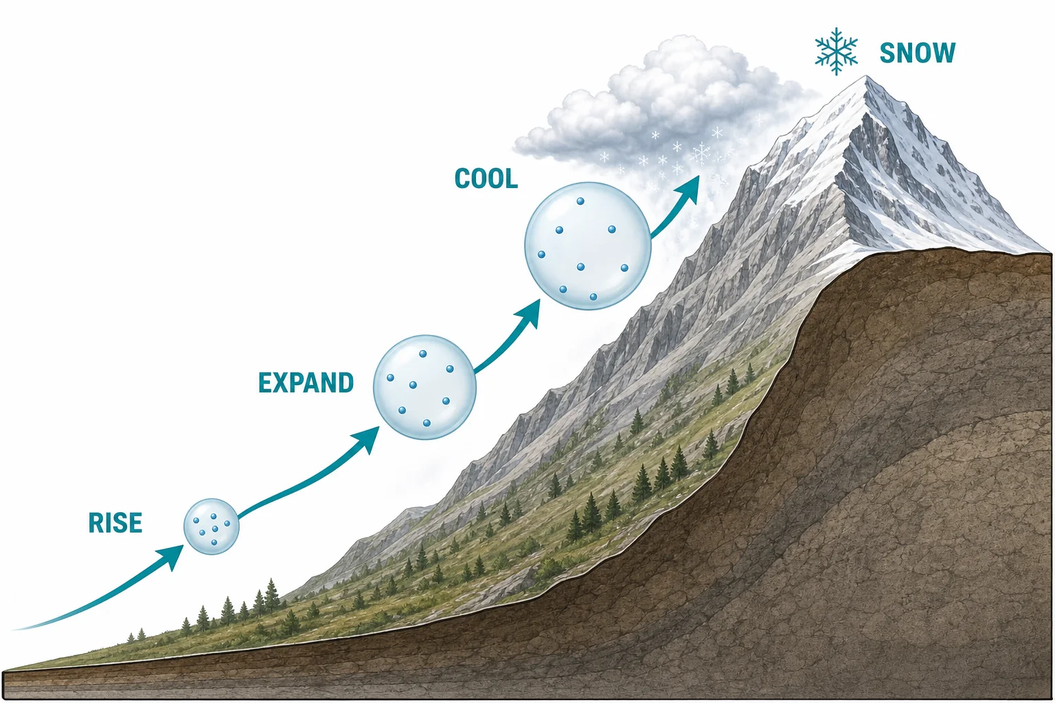
Lower pressure at high altitude lets rising air expand and cool.

Snow falls where air stays below freezing

A storm over a mountain shows rain falling on lower slopes and snow falling near the summit, separated by a snow line.
The snow line shifts with temperature
Snow begins as ice crystals in cold clouds. If the air below the cloud stays below freezing, the crystals can reach the ground as snow. If the air is warmer, they may melt into rain before they land. On a tall mountain, the summit may stay below freezing during a storm even when the valley is far above freezing. That means snow can fall on the top and rain can fall lower down during the same weather event. The line between mostly rain and mostly snow is called the snow line. It moves during the year. In winter, it can be low. In summer, it climbs higher. On very tall mountains, the summer snow line may still be below the summit, so the top keeps receiving or holding snow.

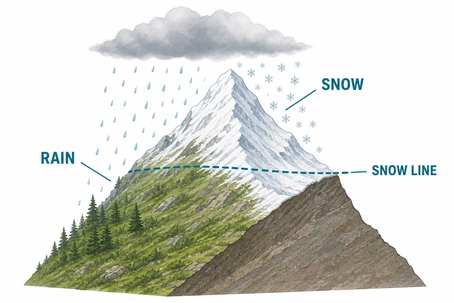
A summit can get snow while nearby lower land gets rain.

Melting is not just about air temperature

Two slopes at the same height show different melting, with a sunny slope mostly bare and a shaded slope holding snow.
Sunlight and shade affect melting
Summer sunlight does melt mountain snow, but several factors can slow the melting. Snow reflects much of the sunlight that hits it. This high reflectivity is called albedo. Clean snow can send a large share of solar energy back to the sky. Shaded slopes also melt more slowly because they receive less direct sunlight. In the Northern Hemisphere, north-facing slopes are often cooler because the Sun stays more to the south in the sky. Wind can remove heat from the snow surface, but warm wind can also speed melting. Dust and soot make snow darker, so it absorbs more energy and melts faster. This is why two slopes at the same altitude can look different in summer. One can be bare rock, while another still holds snow.

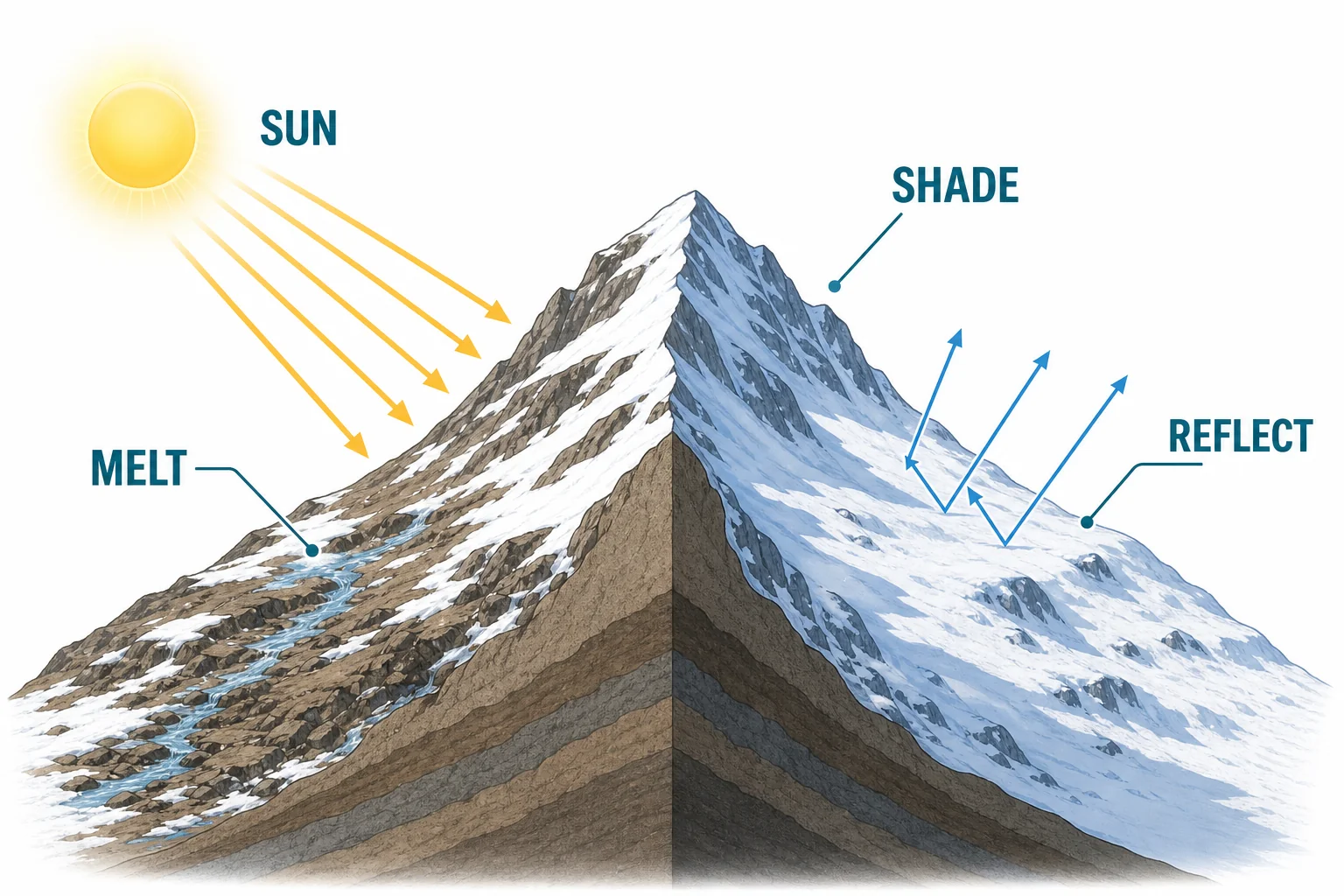
Snow lasts longer where it reflects light or sits in shade.

A snow cap is a balance

A mountain snowfield diagram shows snowfall adding snow and melting streams removing water from the snowpack.
Snow stays when gains match or exceed losses
A summer snow cap remains when the mountain gains or keeps more snow than it loses. Snow is added by storms, wind-blown drifts, and avalanches that pile snow into basins. Snow is removed by melting, evaporation, wind, and flowing ice if a glacier is present. Scientists describe this as a balance between accumulation and loss. If yearly accumulation is greater than yearly loss, snowfields can grow. If loss is greater, they shrink. Climate affects this balance. Warmer air raises the snow line and lengthens the melt season. Changes in storms can add or remove snowfall. That is why mountain snowpack is an important water source and climate signal. Many rivers depend on snow that melts slowly through spring and summer.

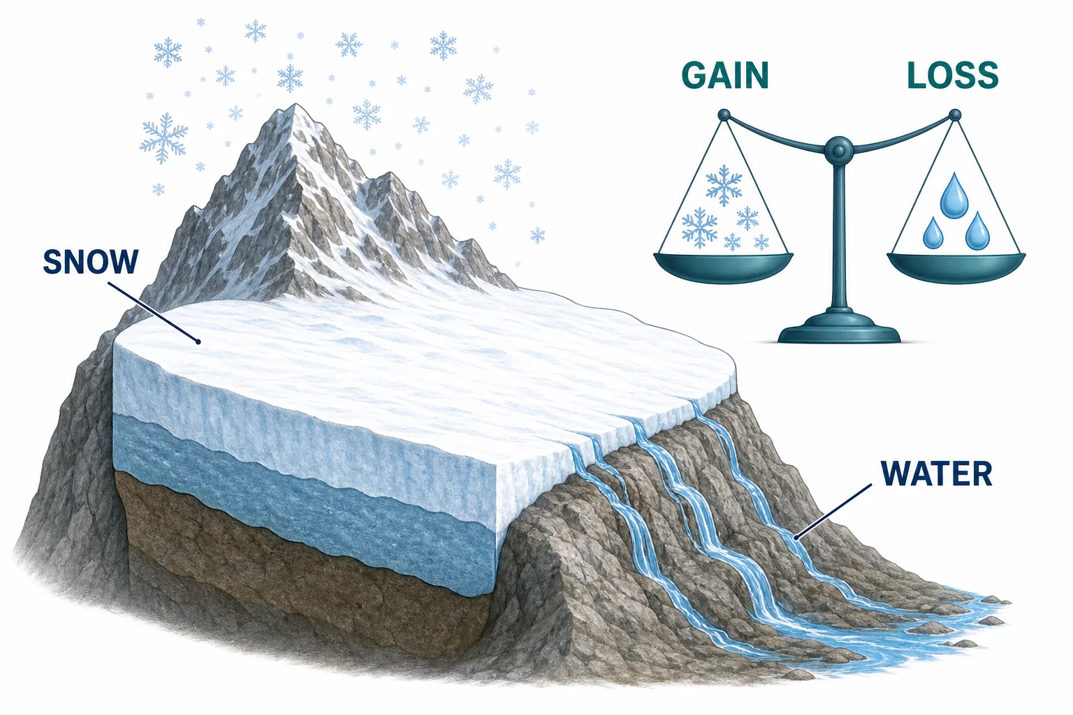
A lasting snow cap depends on both snowfall and melting.

Vocabulary

Altitude
Height above sea level.
Atmospheric lapse rate
The rate at which air temperature changes with height in the atmosphere.
Air pressure
The force from the weight of air pressing on a surface.
Snow line
The elevation where snow can remain on the ground during a season.
Albedo
A measure of how much light a surface reflects.
Snowpack
Layers of snow that build up on the ground over time.

In the Classroom

Map a mountain temperature profile

20 minutes | Grades 6-8

Students start with a valley temperature and use a lapse rate of $6.5\,^{\circ}\mathrm{C}$ per kilometer to estimate temperatures at several elevations. They mark where the temperature crosses freezing and compare that height with a possible snow line.

Model albedo with paper surfaces

25 minutes | Grades 6-8

Place black paper and white paper under the same lamp and measure surface temperature over time. Students connect the results to clean snow, dark rock, and dusty snow on mountains.

Build a snowpack balance chart

30 minutes | Grades 6-8

Students make a simple table of monthly snowfall and melting for a fictional mountain. They graph when the snowpack grows, when it shrinks, and when summer snow can survive.

Key Takeaways

  • Air usually gets colder as altitude increases.
  • Rising air expands in lower pressure and cools.
  • High summits can receive snow while lower slopes receive rain.
  • Shade, albedo, wind, and dust affect how fast snow melts.
  • Summer snow remains when snow gains match or exceed snow losses.
Content generated with AI assistance and reviewed by the LivePhysics editorial team. See sources below for original references.