Interpret earthquake risk maps, compare building choices, and explain how geology and engineering decisions affect seismic safety.
Read each problem carefully. Use evidence from the map, table, or scenario when provided. Show your reasoning in the space provided.
Using seismic hazard information to make safer construction decisions
Earth Science - Grade 9-12
- 1
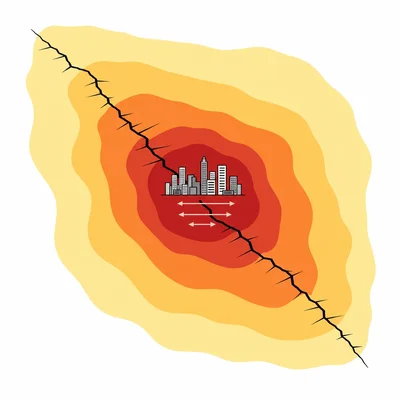
A seismic hazard map shows a city in a zone labeled high peak ground acceleration. Explain what peak ground acceleration means and why a high value matters for building design.
- 2
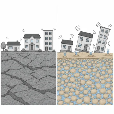
Two towns are the same distance from an active fault. Town A is built on solid bedrock, and Town B is built on loose water-saturated sand. Which town is likely to experience more damage during the same earthquake, and why?
- 3
A developer wants to build a hospital in a region with moderate earthquake hazard. List three building choices that would reduce earthquake risk for this hospital.
- 4
A risk map shows a high hazard zone along a fault, but the population density there is very low. Another area has moderate hazard but very high population density. Explain why the moderate hazard area could still have higher overall earthquake risk.
- 5
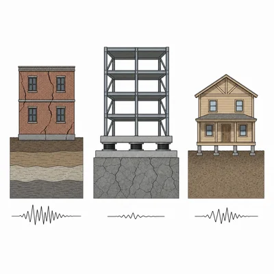
Use this building table: Building 1 is unreinforced brick on soft soil. Building 2 is steel frame with base isolation on bedrock. Building 3 is wood frame on firm soil. Rank the buildings from highest to lowest expected earthquake safety and explain your ranking.
- 6
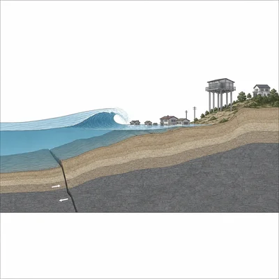
A coastal city has a high earthquake hazard and some areas are less than 10 meters above sea level. What additional earthquake-related hazard should planners consider, and what is one building or planning choice that can reduce danger?
- 7
Explain why an earthquake risk map should be updated after scientists discover a previously unmapped fault near a growing suburb.
- 8
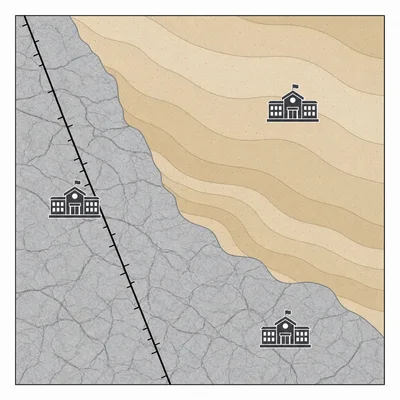
A city map shows three possible school sites. Site A is near a fault on bedrock, Site B is far from the fault on soft sediment, and Site C is far from the fault on bedrock. Based only on this information, which site is likely the best choice for earthquake safety, and why?
- 9
A homeowner says, "My house is only one story tall, so earthquake risk maps do not matter for me." Explain why this statement is incorrect.
- 10
A map uses darker colors to show higher expected shaking. A proposed emergency operations center is located in the darkest zone. Explain why this location creates a special concern and suggest a better decision.
- 11
Describe the difference between seismic hazard and seismic risk using an example related to building choices.
- 12
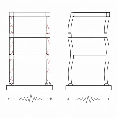
A city requires new apartment buildings in high hazard zones to have ductile frames. Explain what ductility is and why it helps during an earthquake.
- 13
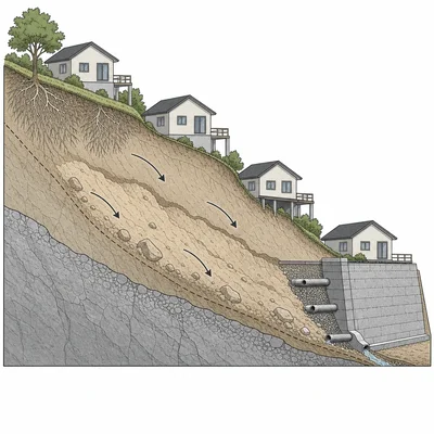
A neighborhood is located on a steep slope in a region with frequent earthquakes. What hazard should be added to the earthquake risk assessment, and what are two ways to reduce the risk?
- 14
A public official wants to use only past earthquake locations to decide where buildings must meet stricter codes. Explain one limitation of this approach.
- 15
You are advising a town council choosing between retrofitting an old unreinforced masonry library or building a new library on a soft sediment site. What information would you ask for before making a recommendation, and why?