Earthquake Feed Map
Explore a snapshot of about 150 real earthquakes from the USGS catalog. Filter the map by magnitude, depth, tectonic region, and year to uncover the global pattern of seismic activity along plate boundaries.
Guided Experiment Find the Pacific Ring of Fire
Where do the most earthquakes occur on Earth? Do they appear evenly distributed or do they cluster in a recognizable pattern? Predict where you expect to see the highest density of events.
Write your hypothesis in the Lab Report panel, then click Next.
World Map
Loading map...
Controls
Magnitude range
Depth category
Tectonic region
Year range
Statistics
Magnitude distribution
Data Table
(20 rows)| # | Magnitude | Depth (km) | Location | Date | |
|---|---|---|---|---|---|
| 1 | |||||
| 2 | |||||
| 3 | |||||
| 4 | |||||
| 5 | |||||
| 6 | |||||
| 7 | |||||
| 8 | |||||
| 9 | |||||
| 10 | |||||
| 11 | |||||
| 12 | |||||
| 13 | |||||
| 14 | |||||
| 15 | |||||
| 16 | |||||
| 17 | |||||
| 18 | |||||
| 19 | |||||
| 20 |
Reference Guide
Richter and Moment Magnitude
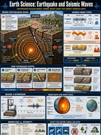
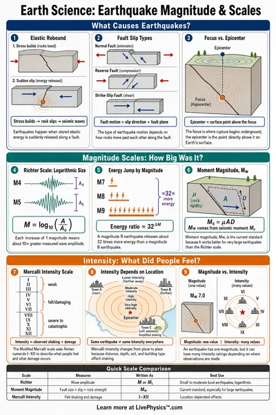
Earthquake magnitude is reported on a logarithmic scale. Each whole unit represents about 32 times more released energy and a 10 times larger ground motion amplitude.
A magnitude 7.0 quake releases roughly 1,000 times more energy than a 5.0 event. The largest recorded event was the 1960 Valdivia earthquake at moment magnitude 9.5.
The original Richter scale has been largely replaced by the moment magnitude scale (Mw), which is based on the seismic moment and is more accurate for large earthquakes.
Earthquake Depth Categories
Seismologists group earthquakes by hypocentre depth into three bands.
- Shallow. Less than 70 km. Most damaging events. Common at all plate boundaries.
- Intermediate. 70 to 300 km. Common in subduction zones.
- Deep. Over 300 km. Found only behind subduction zones, sometimes below 600 km.
Deep events follow the Wadati-Benioff zone, where the subducting slab descends into the mantle. The deepest events approach the limit at which slabs become too warm to fracture.
Plate Tectonics and the Ring of Fire
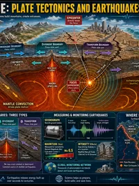
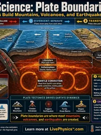
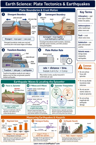
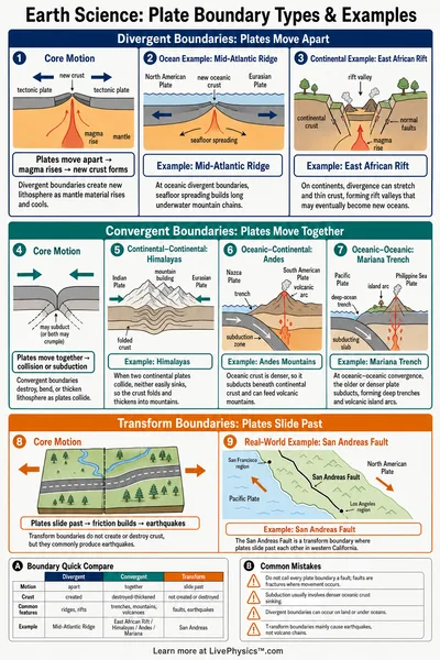
Earth's outer shell is broken into about a dozen tectonic plates that move relative to each other. Most earthquakes occur where plates meet.
The Pacific Ring of Fire is a horseshoe shaped belt around the Pacific Ocean where the Pacific Plate slides past or beneath neighboring plates. About 90 percent of the world's earthquakes occur here, including most of the largest.
Mid-ocean ridges produce small, shallow events as plates pull apart. Continental collisions like the Himalayas produce shallow but powerful events far inland.
USGS Earthquake Catalog
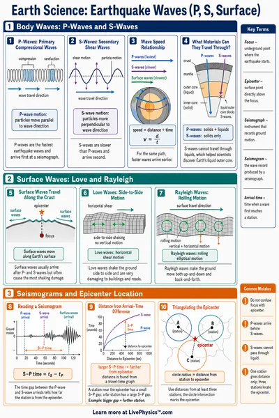
The United States Geological Survey maintains a global earthquake catalog updated within minutes of each event. Stations from the Global Seismographic Network record ground motion around the world.
Each event entry includes magnitude, depth, latitude, longitude, origin time, and a region name. The catalog filters out blasts and noise to focus on tectonic events.
This lab uses a static snapshot of around 150 historically significant and representative events. For real-time data and deeper exploration, visit earthquake.usgs.gov.