Analyze major post-classical trade networks, including their goods, technologies, cultural exchanges, and historical effects.
Read each problem carefully. Use specific historical evidence in your answers. Show your reasoning in the space provided.
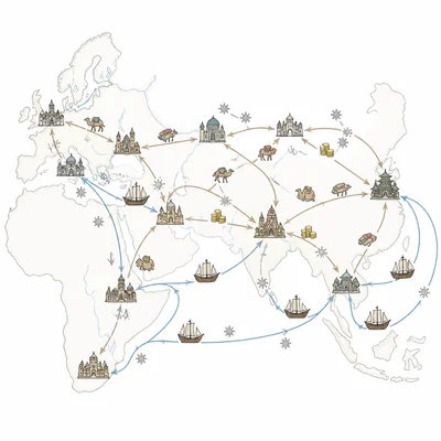
Silk Roads, Indian Ocean, and Trans-Saharan connections from c. 1200 to c. 1450
Social Studies - Grade 9-12
- 1
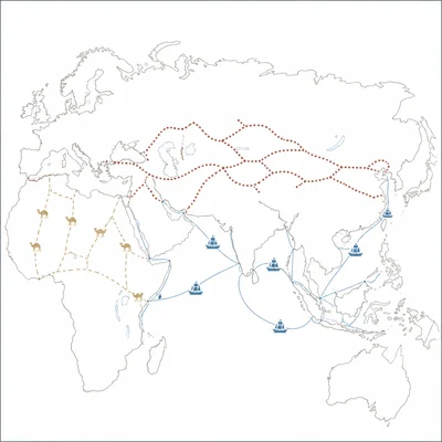
Identify the three major long-distance trade networks that connected Afro-Eurasia during the post-classical period from about 1200 to 1450.
- 2
Explain one reason why luxury goods such as silk, porcelain, spices, and precious metals were often traded over long distances.
- 3
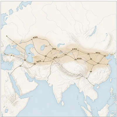
Describe how the Mongol Empire affected trade on the Silk Roads.
- 4
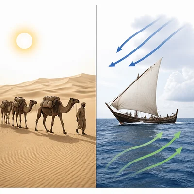
Compare the role of camels in Trans-Saharan trade with the role of monsoon winds in Indian Ocean trade.
- 5
Explain how the spread of Islam influenced trade across the Indian Ocean and the Sahara.
- 6
A historian claims, 'Trade networks mainly moved goods, not ideas.' Use one specific example from the post-classical period to challenge this claim.
- 7
Describe one way that trading cities such as Kilwa, Malacca, Kashgar, or Timbuktu benefited from their locations.
- 8
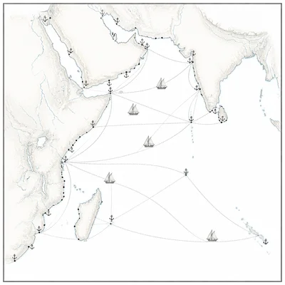
Explain the historical significance of the Swahili city-states in the Indian Ocean trade network.
- 9
What was one major effect of improved commercial practices, such as bills of exchange, credit, and banking, on post-classical trade?
- 10
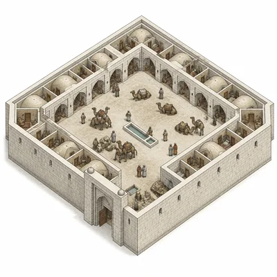
Analyze how caravanserais supported trade across Central Asia and the Middle East.
- 11
Explain why diasporic merchant communities formed in port cities around the Indian Ocean.
- 12
Use the terms 'continuity' and 'change' to describe one pattern in post-classical trade networks from c. 1200 to c. 1450.
- 13
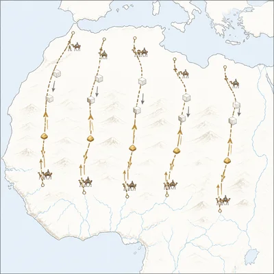
A map shows gold moving north from West Africa and salt moving south from North Africa. Identify the trade network and explain why both goods were important.
- 14
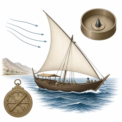
Explain how technological innovations such as the magnetic compass, astrolabe, and improved ship designs affected Indian Ocean trade.
- 15
Explain how long-distance trade contributed to both economic growth and the spread of disease in the post-classical period.