Atlantic shelf and ridge
Start at A near the coast of North America. Find where the shallow continental shelf gives way to the deep ocean basin, then look for the Mid-Atlantic Ridge near the middle of the basin.
Draw a line across an ocean and see how the seafloor rises and falls. Compare a continental shelf, a mid-ocean ridge, and a deep trench in elevation profiles from real data.
Drag a line or pick point A.
Use decimal degrees. South and west are negative.
Loading global elevation data…
Start at A near the coast of North America. Find where the shallow continental shelf gives way to the deep ocean basin, then look for the Mid-Atlantic Ridge near the middle of the basin.
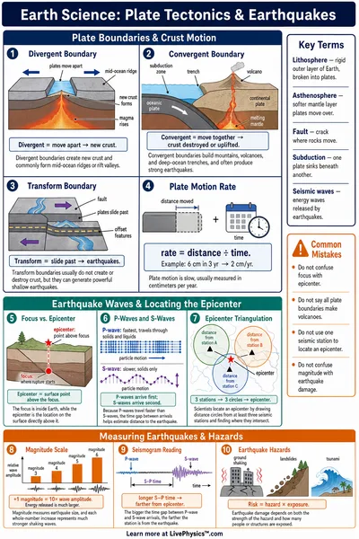
Find the deepest part of the transect and compare it with the slopes on either side. The narrow dip forms where the Pacific Plate bends down into a subduction zone.
Look for a broad rise in the ocean floor. New oceanic crust forms here as plates spread apart, and the crust cools and subsides as it moves away.
The transect follows a great circle, the shortest route between two points on a sphere. The horizontal axis measures distance from A. The vertical axis shows elevations in metres relative to sea level. Positive values are above sea level and negative values are below it. The chart expands the vertical scale to make changes in depth visible.
The lab samples the GEBCO_2020 Grid at about 0.1° spacing, roughly 11 km north to south. Values between cells are interpolated, so narrow features can appear shallower or smoother than they are. Use this educational map for regional comparisons. GEBCO excludes navigation from its permitted uses.
GEBCO_2020 documentation · Dataset citation
Continue with the ocean-floor mapping worksheet, the Sea Level Map, or the Ocean Currents Explorer.