Weather Radar Analyzer
Examine simulated NEXRAD reflectivity snapshots from five famous storms. Identify storm structure on radar, compare convective and stratiform precipitation, and estimate rainfall intensity from dBZ values using the Marshall-Palmer relation.
Guided Experiment Identify the Hook Echo in the Joplin Tornado
A hook echo is a curved appendage of reflectivity on the southwest flank of a supercell. Where do you expect to find it on the Joplin radar frame, and what reflectivity range should it have?
Write your hypothesis in the Lab Report panel, then click Next.
Reflectivity (dBZ)
Below 5 dBZ is hidden.
Controls
Values below this threshold are hidden. Raise it to isolate the most intense cells.
Storm Analysis
Notable Features
- Hook echo on the SW flank
- Bounded weak echo region (mesocyclone inflow)
- Peak reflectivity above 65 dBZ near the tornado
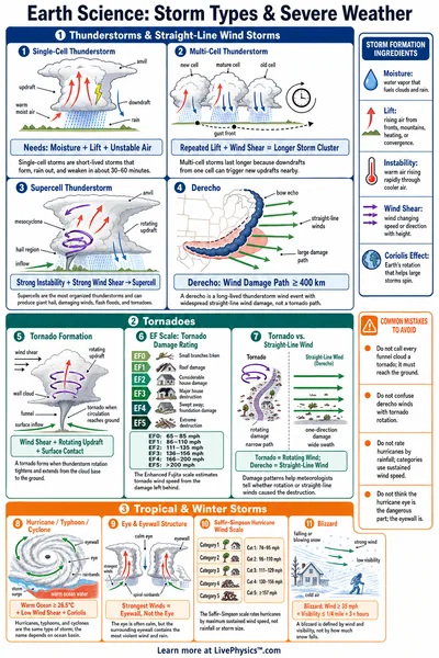
A classic supercell signature. The hook echo curl on the southwest side wraps around the rotating mesocyclone. The Joplin tornado was rated EF5 and tracked east through the city.
Data Table
(0 rows)| # | Storm | Peak Reflectivity(dBZ) | Peak Rain Rate(mm/hr) | Severe Area (>= 50 dBZ)(km^2) | Moderate Area (>= 35 dBZ)(km^2) | Notable Features |
|---|
Reference Guide
How Weather Radar Works
A NEXRAD station transmits a narrow microwave pulse and listens for the energy scattered back by raindrops, hail, snow, and (rarely) tornado debris. The time delay gives the distance, and the strength of the return gives the reflectivity.
Reflectivity is reported as dBZ. Heavier precipitation and larger droplets return more energy, producing a higher dBZ value.
dBZ Reflectivity Scale
The NWS color scale uses cyan and blue for light returns, green for moderate, yellow and orange for heavy, red for very heavy, and magenta or purple for extreme reflectivity (often hail).
- Below 20 dBZ. Light drizzle, snow, or virga.
- 20 to 35 dBZ. Light to moderate rain.
- 35 to 50 dBZ. Heavy rain.
- Above 50 dBZ. Severe convection, large drops, often hail.
- Above 65 dBZ. Often a sign of hail or tornado debris.
Marshall-Palmer Z-R Relation
Rainfall rate R (in mm/hr) is estimated from radar reflectivity Z (in mm<span class="katex"><span class="katex-mathml"><math xmlns="http://www.w3.org/1998/Math/MathML"><semantics><mrow><msup><mrow></mrow><mn>6</mn></msup></mrow><annotation encoding="application/x-tex">^6</annotation></semantics></math></span><span class="katex-html" aria-hidden="true"><span class="base"><span class="strut" style="height:0.8141em;"></span><span class="mord"><span></span><span class="msupsub"><span class="vlist-t"><span class="vlist-r"><span class="vlist" style="height:0.8141em;"><span style="top:-3.063em;margin-right:0.05em;"><span class="pstrut" style="height:2.7em;"></span><span class="sizing reset-size6 size3 mtight"><span class="mord mtight">6</span></span></span></span></span></span></span></span></span></span></span>/m<span class="katex"><span class="katex-mathml"><math xmlns="http://www.w3.org/1998/Math/MathML"><semantics><mrow><msup><mrow></mrow><mn>3</mn></msup></mrow><annotation encoding="application/x-tex">^3</annotation></semantics></math></span><span class="katex-html" aria-hidden="true"><span class="base"><span class="strut" style="height:0.8141em;"></span><span class="mord"><span></span><span class="msupsub"><span class="vlist-t"><span class="vlist-r"><span class="vlist" style="height:0.8141em;"><span style="top:-3.063em;margin-right:0.05em;"><span class="pstrut" style="height:2.7em;"></span><span class="sizing reset-size6 size3 mtight"><span class="mord mtight">3</span></span></span></span></span></span></span></span></span></span></span>) with the empirical relation
where Z is the linear reflectivity factor and dBZ is the decibel form, .
The relation overestimates rain rate when hail is present and underestimates it for very small drops.
Supercell Hook Echo and BWER
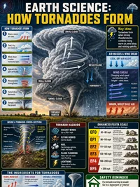
A supercell with a rotating mesocyclone often shows a curved hook of reflectivity wrapping around the rotation on the southwest flank. A tight ball of very high reflectivity inside the hook is sometimes lofted debris from a tornado on the ground.
The bounded weak echo region is a low-reflectivity notch on the inflow side, where strong updraft prevents droplets from growing large enough to scatter the radar beam.
Hurricane Eye and Eyewall
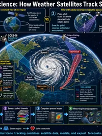
A mature hurricane shows a calm low-reflectivity eye surrounded by a tight ring of intense convection called the eyewall. Spiral rain bands trail outward from the eyewall and wrap counter-clockwise in the northern hemisphere.
The eye is roughly circular and 5 to 60 km in diameter. The eyewall is where the most damaging winds occur.
Bow Echo and Derecho
A bow echo is a curved squall line with the apex bowing in the direction of motion. The notch behind the apex marks the rear-inflow jet, which can accelerate to the surface and produce a long swath of damaging straight-line winds called a derecho.
Bow echoes often have a north and south bookend, with small areas of higher reflectivity at each end of the line.
About the Snapshots
The five storm snapshots in this lab are not raw NEXRAD data. They are hand-synthesized reflectivity fields modeled after well-known cases so the classic structures of each storm are clearly visible. Real NEXRAD reflectivity from these events is publicly archived at the NCEI radar archive.
For more on Doppler radar fundamentals see the NWS JetStream introduction to Doppler radar .