Why Are Some Places Always Cold?
Sun angle, water, and height shape cold climates
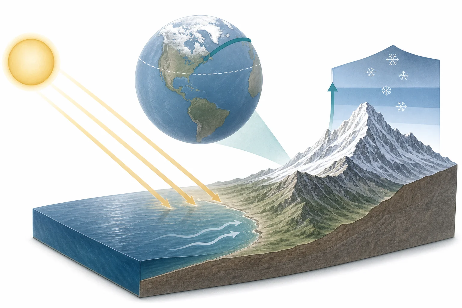
Some places stay cold because sunlight reaches them at a low angle, so the same energy spreads over a larger area. Cold ocean water, sea ice, and nearby mountains can keep air cool for much of the year. High places are also colder because air expands and cools as it rises.
Cold places are not cold for just one reason. A village near the Arctic Ocean, a high mountain town, and a windy island near Antarctica can all feel cold, but the causes can be different. Earth gets energy from the Sun. Near the equator, sunlight hits the ground more directly. Near the poles, sunlight arrives at a low angle and spreads out. Some areas also lose heat fast because snow and ice reflect light. Ocean currents can carry cold water along a coast and cool the air above it. Mountains add another effect. Higher air pressure is lower, and rising air cools. This helps explain why a tropical mountain can have snow near the top. Climate is the long-term pattern of weather in a place. To understand cold climates, scientists look at sunlight, water, elevation, and how Earth moves energy around.
Sunlight spreads out
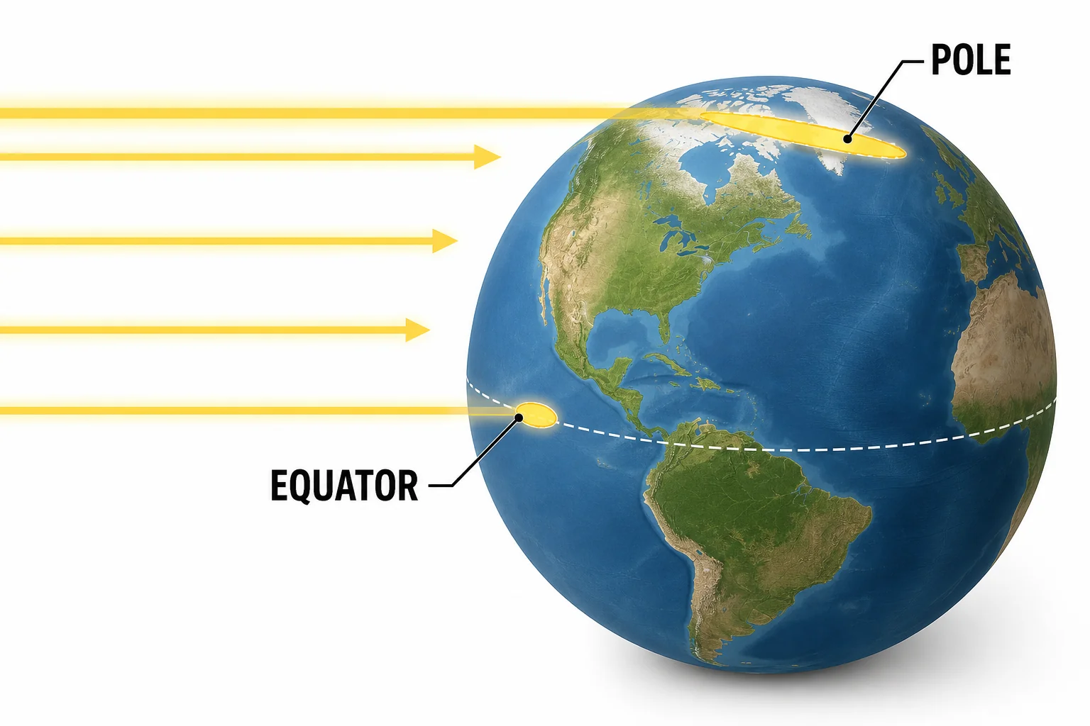
Low-angle sunlight gives each square meter less energy.
Polar circles change daylight
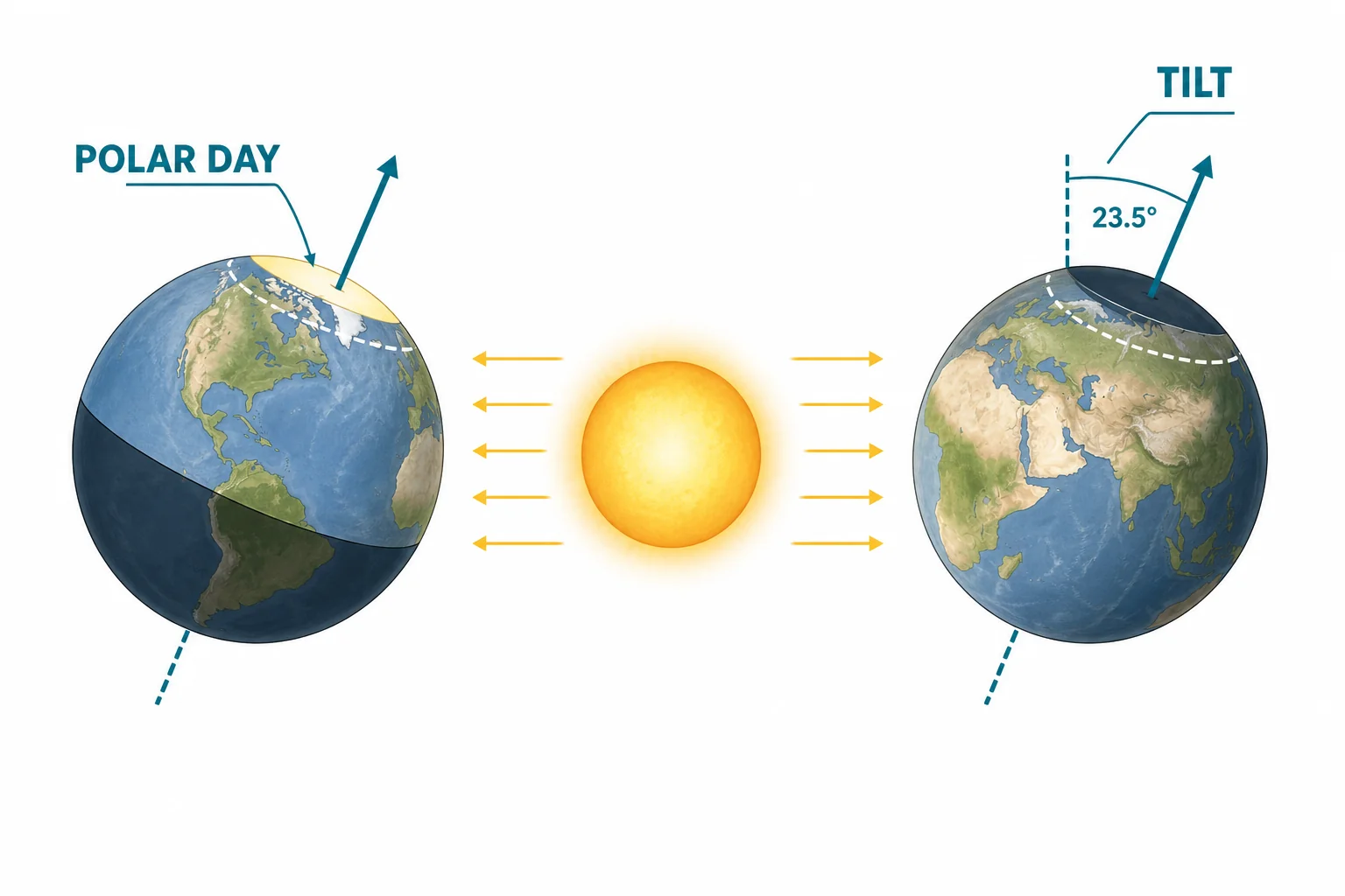
Long days do not always mean strong heating.
Ocean currents move heat
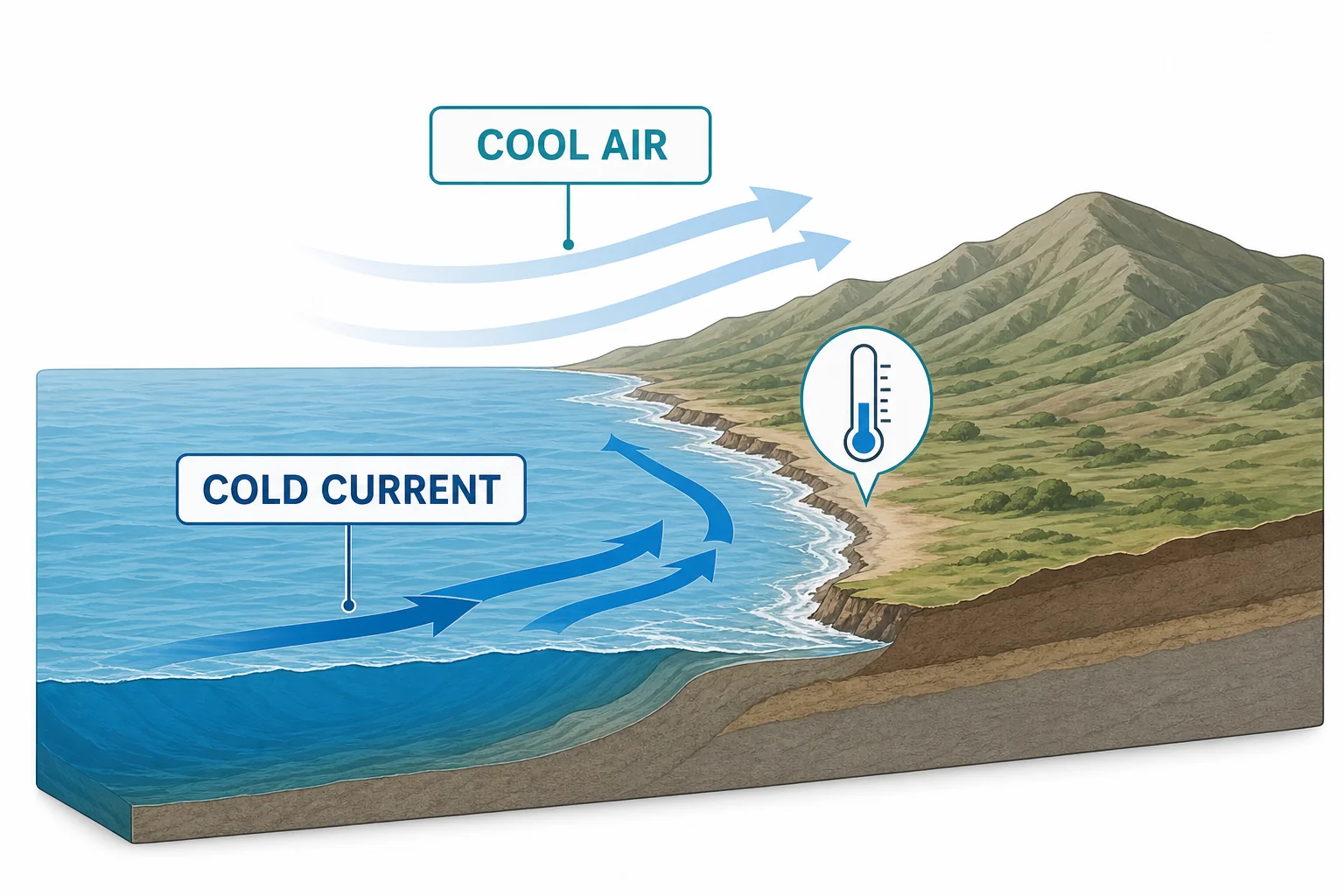
A coast can be cold when nearby ocean water is cold.
Higher places are colder
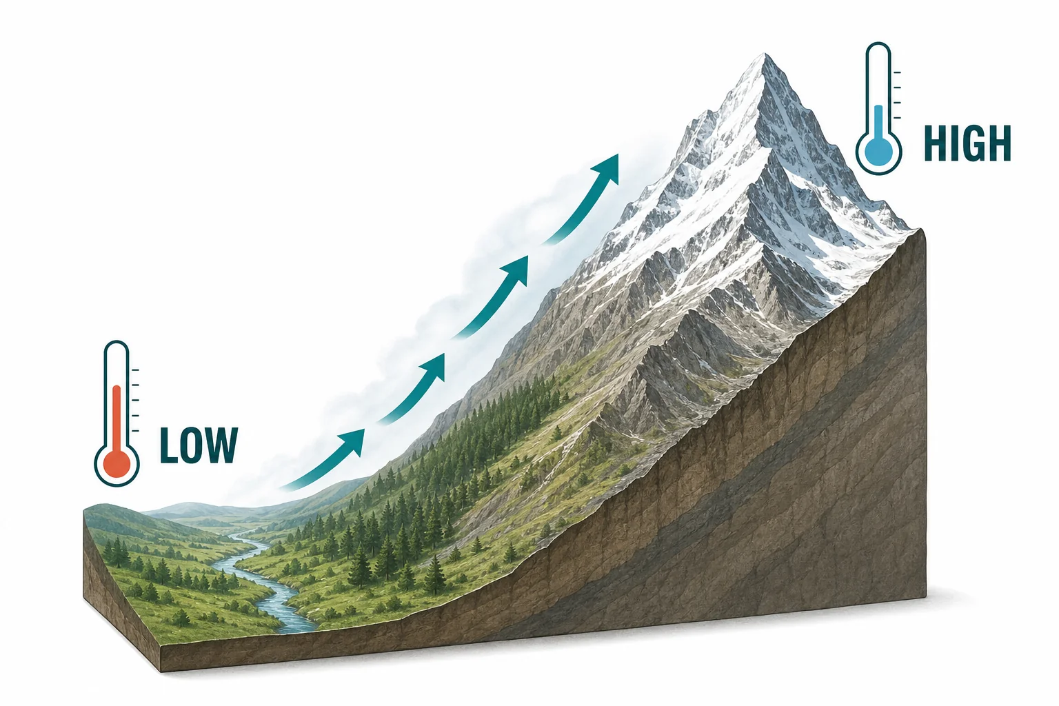
High elevation can create cold conditions far from the poles.
Cold places combine causes
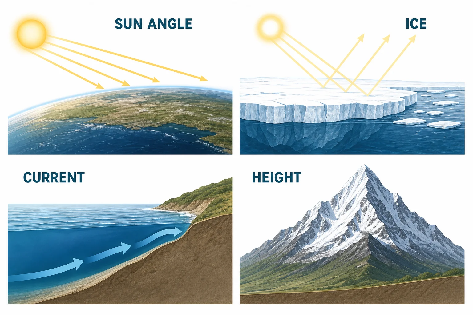
Cold climates are patterns made by sunlight, water, ice, and landforms.
Vocabulary
- Latitude
- Distance north or south of the equator, measured in degrees.
- Climate
- The long-term pattern of weather in a place, usually studied over many years.
- Ocean current
- A large, steady movement of ocean water that can carry heat from one region to another.
- Elevation
- Height above sea level.
- Polar circle
- One of the two latitude lines where at least one full day of daylight and one full day of darkness happen each year.
- Albedo
- A measure of how much sunlight a surface reflects.
In the Classroom
Flashlight Sun angle model
20 minutes | Grades 6-8
Students shine a flashlight straight down on paper, then at a low angle. They trace the bright area and compare how the same light spreads out. Connect the model to latitude and polar climates.
Climate factor map sort
30 minutes | Grades 6-8
Give students cards with places such as Antarctica, Greenland, the Andes, and a cold-current coast. Students sort each place by likely causes of cold conditions. They should use more than one cause when the evidence supports it.
Elevation temperature graph
25 minutes | Grades 6-8
Students graph temperature data from several elevations on a mountain. They look for a pattern and write a short claim about how elevation affects temperature. Add a discussion about why latitude alone cannot explain every climate.
Key Takeaways
- • High-latitude places are colder because sunlight reaches them at a lower angle.
- • Polar circles have extreme daylight patterns because Earth is tilted.
- • Cold ocean currents and sea ice can cool nearby air and land.
- • Higher elevation usually means cooler temperatures.
- • Most cold climates are shaped by several factors at the same time.