Map Projection & Distortion Explorer
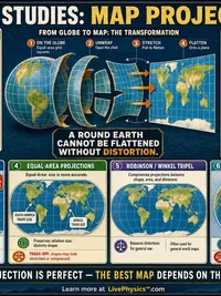
A round Earth cannot be flattened without distortion. Switch projections and watch the graticule and distortion circles change, then compare two regions to see how the map can mislead the eye.
Controls
Projection
Equal circles drawn on the globe. They stay round when shape is preserved and grow or flatten where the map distorts.
Area scale here is about 4.00 × true area on the Mercator projection.
Mercator projection
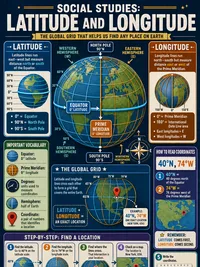
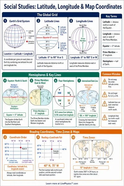
Graticule with parallels and meridians every 30°. Equal circles on the globe (Tissot) reveal where the map distorts.
What Mercator preserves
A conformal projection that keeps local shapes and compass angles correct, which made it ideal for navigation. The cost is area. Regions near the poles are inflated enormously, which is why Greenland can look as large as Africa.
Area inflation by latitude
How many times larger a region appears than its true size on this projection. A value of 1 means true area.
| Latitude | 0° | 30° | 45° | 60° | 75° |
|---|---|---|---|---|---|
| Area scale | 1.00× | 1.33× | 2.00× | 4.00× | 14.93× |
Greenland vs Africa
On the Mercator map, Greenland appears about 75% the size of Africa, but its true area is only about 7% of Africa.
That is the Mercator illusion. Greenland sits at a high latitude, so the map inflates it far beyond its real share of the world.
How Map Projections Work
Why you cannot flatten a sphere
A sphere has no flat layout. Peel an orange and try to press the skin flat and it tears or stretches. Maps face the same problem, so every projection must trade away something.
A projection can keep shapes correct, or sizes correct, but not both at once across the whole map. The grid of parallels and meridians, called the graticule, shows where the stretching happens.
Conformal vs equal-area
A conformal projection like Mercator keeps local shapes and compass angles correct, which is why it was made for navigation. The price is area, which balloons near the poles.
An equal-area projection like Lambert or Mollweide keeps every region at its true relative size. The price is shape, which gets squashed or sheared. The Tissot circles make the tradeoff visible.
Why Mercator exaggerates the poles
On Mercator the area scale grows as the square of the secant of the latitude. At 60° a region looks about 4 times its true size, and the effect keeps climbing toward the poles.
- Greenland can look as large as Africa, yet Africa is about 14 times bigger.
- Equal-area maps fix the size illusion at the cost of shape.
- Use the compare tool to read the displayed size against the true size.